

At its simplest level, a Geographic Information System (GIS) is a computer system used for capturing, storing, checking, and displaying data related to positions on Earth’s surface.
However, for a founder or business operator, that definition barely scratches the surface of what the technology actually does. If you are building a business that interacts with the physical world in any capacity, GIS is likely the engine that will drive your decision making.
Most people confuse GIS with digital maps. While maps are the most common output of a GIS, the system itself is much more robust. It is a tool for spatial analysis. It connects data to a map and integrates location data with all types of descriptive information. This integration allows you to understand patterns, relationships, and geographic context that a standard spreadsheet simply cannot show you.
Imagine you are looking at a spreadsheet of customer addresses. You see rows and columns. Now imagine those addresses plotted on a map, overlaid with data regarding local income levels, zoning laws, and competitor locations. Suddenly, the data tells a story. That is the function of GIS.
It allows you to visualize, question, analyze, and interpret data to understand relationships, patterns, and trends. For a startup, this is the difference between guessing where your market is and knowing exactly where to deploy your limited resources.
The Components of a GIS
#To understand how to use this in your business, you need to understand the mechanics. A working GIS integrates five key components: hardware, software, data, people, and methods.
Hardware
This is the computer on which the GIS operates. Today, this runs the gamut from centralized computer servers to desktop computers used in standalone or networked configurations. Increasingly, this hardware is mobile. Field teams use tablets and phones to collect data that feeds directly into the system.
Software
GIS software provides the functions and tools needed to store, analyze, and display geographic information. Key software components include tools for the input and manipulation of geographic information, a database management system (DBMS), tools that support geographic query, analysis, and visualization, and a graphical user interface (GUI) for easy access to tools.
Data
This is the most critical component. Geographic data and related tabular data can be collected in-house or purchased from a commercial data provider. A GIS integrates spatial data with other data resources and can even use a DBMS to organize and maintain data to manage it.
There are two main types of data you will encounter:
- Vector Data: This represents geographic features as points, lines, or polygons. Think of a customer’s house (point), a delivery route (line), or a zip code boundary (polygon).
- Raster Data: This represents data as a grid of cells or pixels. Satellite imagery and digital aerial photographs are the most common examples here.
People
GIS technology is of limited value without the people who manage the system and develop plans for applying it to real world problems. For a startup, this might be a dedicated data scientist, or it might be you hacking together a solution using open source tools.
Methods
A successful GIS operates according to a well-designed plan and business rules, which are the models and operating practices unique to each organization.
GIS vs. GPS: Understanding the Difference
#It is common for founders to use the terms GIS and GPS interchangeably, but they are fundamentally different technologies that serve different purposes in a business stack.
GPS (Global Positioning System) is a satellite-based navigation system. Its primary job is to tell you where something is right now. It provides coordinates. It answers the question: “Where am I?” or “Where is my driver?”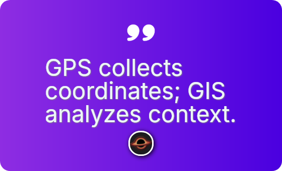
GIS (Geographic Information System) is the software that makes sense of that location data. It takes the coordinate provided by the GPS and tells you what is at that location, what is near that location, and why that location matters. It answers the question: “Why is my driver delayed here?” or “How many potential customers live within five miles of this coordinate?”
Think of GPS as the data collector and GIS as the data analyst. GPS gives you a dot on a blank screen. GIS paints the map under the dot, adds the traffic layer, overlays the weather data, and calculates the most efficient route to the next dot.
If you are building a logistics startup, GPS tells you where the truck is. GIS tells you which route is most fuel efficient based on elevation changes and historical traffic patterns.
Applications for Startups
#You do not need to be building a navigation app to need GIS. The applications span across almost every industry where physical location has relevance.
Market Analysis and Site Selection
Retail and brick-and-mortar businesses live and die by location. GIS allows you to analyze demographic data to find the optimal location for a new store. You can layer income data, population density, and competitor locations to find the gaps in the market.
Supply Chain and Logistics
Startups focusing on delivery or physical goods use GIS to optimize routes. This is not just about finding the shortest path. It is about analyzing road quality, speed limits, and delivery windows to optimize fuel costs and labor hours.
Customer Segmentation
By mapping your current customer base, you can identify clusters. If you see a high concentration of users in a specific neighborhood, you can analyze the characteristics of that neighborhood to find similar areas elsewhere. This creates a blueprint for targeted marketing.
Risk Management
Insurance and real estate tech (PropTech) companies use GIS to assess risk. This involves layering flood zones, fire hazard areas, and crime statistics over specific property parcels to determine insurance premiums or investment viability.
Critical Questions for Founders
#Implementing GIS is not just about buying software. It requires a scientific approach to your data strategy. As you look at integrating spatial data into your business model, you need to confront several unknowns.
Data Accuracy and Freshness
The world changes faster than databases do. A road that existed six months ago might be closed today. A vacant lot might now be an apartment complex. You must ask how you will verify the currency of your data. If you base your business decisions on outdated maps, you will lose money. What is your mechanism for data validation?
Privacy and Ethics
GIS allows for incredibly granular tracking of human behavior. When you overlay enough data points, you can learn things about individuals that they never explicitly told you. Where is the line between optimizing your service and infringing on user privacy? As a founder, you have to navigate this ethical landscape before you find yourself in a PR crisis.
Correlation vs. Causation
Just because two things overlap on a map does not mean they are related. High sales in a specific area might correlate with a nearby landmark, but that does not mean the landmark caused the sales. How will you ensure your analysis is identifying real drivers of business success rather than just convenient coincidences?
The Build vs. Buy Decision
Do you need a full enterprise suite like ArcGIS, or can you survive on open source tools like QGIS? Do you need to hire a geospatial analyst, or can you use an API from Google Maps or Mapbox? These are resource allocation questions that impact your runway.
GIS provides the “where” context that is often missing from standard business intelligence. It grounds your metrics in the real world. By understanding the spatial relationships inherent in your market, you build a more resilient and informed operation.